Travel along the 1,433-mile Interstate 15 corridor can take one into six U.S. states and near both the U.S.- Canada and U.S.-Mexico borders within a day, if necessary. While the shortest stretch of I-15 will take you through 29 miles of Arizona, its longest stretches are found along over 400 miles of Utah and nearly 400 miles of Montana.
Across 30 counties — encompassing locations along the route from California, Arizona, Nevada, Utah, Idaho and Montana — more than 275 qualified investments were tracked by Site Selection’s proprietary Conway Project Database from January 2024 to April 2026. It’s no surprise that the Interstate’s vital connection points have paved the way for a heavy concentration of transportation & logistics operations.
In that two-year-plus period, the Transportation & Logistics sector led with 60 new or expansion project investments, followed by Machinery, Equipment & Construction (38 projects), Life Sciences (24 projects), IT & Communications (22 projects) and Consumer Products (15 projects). Not accounting for IT & Communication investments, the majority of these investments were delivered to distribution & warehousing and manufacturing operations with proximity to I-15.
Corporate leaders across these industries and more showed favor to four particular counties along the route. In California, San Diego and San Bernardino counties tied with 55 projects each as Salt Lake County in Utah barely missed a three-way tie with 54 projects. Nevada’s Clark County followed with 51 projects.
Riverside Traffic Flows with New Technology
As for metro areas, the I-15 project count climbs to 73 projects over two years in the Riverside-San Bernardino-Ontario metro region in Southern California. According to Riverside County Transportation Commission (RCTC) Public Affairs Manager Ariel Tapia, tremendous growth in the southwest region led the commission to begin exploring viable ways to improve flow of traffic on the interstate, especially during peak commute hours from three to seven. The team looked into traffic technologies around the world, finding a technology first implemented in Melbourne, Australia, that had proved to be effective.
“We thought, ‘Let’s do something innovative and new here in Southern California.’ Building a new lane in California is very expensive and takes a long time,” says Tapia. “This way we can put a system in place that is more cost-effective and has been proven to actually work and get traffic moving in other areas.”
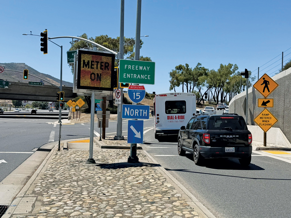
In an effort to improve traffic operations while enhancing a driver’s travel time in the region, RCTC and various partners in June 2026 launched a 2-year I-15 Smart Freeway Pilot Project. The $33 million pilot project forms an 8-mile, non-tolled segment along the northbound I-15 route from Temecula to Murrieta, which now features advanced sensors and the Melbourne-based intelligent transportation system to monitor real-time traffic conditions 24/7. This specific segment was selected due to congestion issues previously identified by RCTC.
The traffic system is the first of its kind anywhere in California. Tapia says there was some convincing that had to be done, but entities including the California Department of Transportation (Caltrans) were very supportive of the initiative.
“We are working on the highway which Caltrans owns and operates, so we needed to get support and buy-in from them,” he says. “We also had the neighboring cities, the City of Temecula and the Western Riverside Council of Governments, so all of these project partners came together and said yes to trying something new and seeing if it works for us.”
On-ramps at Temecula Parkway, Rancho California Road and Winchester Road had regular traffic meters replaced with adaptive ramp meters, which feed information to the pilot’s sensors and the back-office system. The new ramp meters work as a coordinated system, actively adjusting to allow more or fewer vehicles to enter I-15 and displaying recommended speeds on new digital message signs.
“We’ve seen a 67% increase in residents coming from other parts of the state and even other parts of the country,” says Tapia. “This project is one of the many solutions RCTC has been pursuing to improve traffic for residents and businesses. We know a lot of businesses are opening up in Temecula and this project is meant to help people move.”
He notes that if people aren’t moving, the economy isn’t moving. The I-15 Smart Freeway Pilot Project is one piece in preparing for continued growth. Prior to the pilot’s official launch, a 90-day baseline data collection period was conducted to track average traffic flows, vehicle speed and number of accidents, giving the team a solid basis to weight the results against.
Tapia says RCTC will also be launching its own public safety dashboard to share updates of the system’s performance.
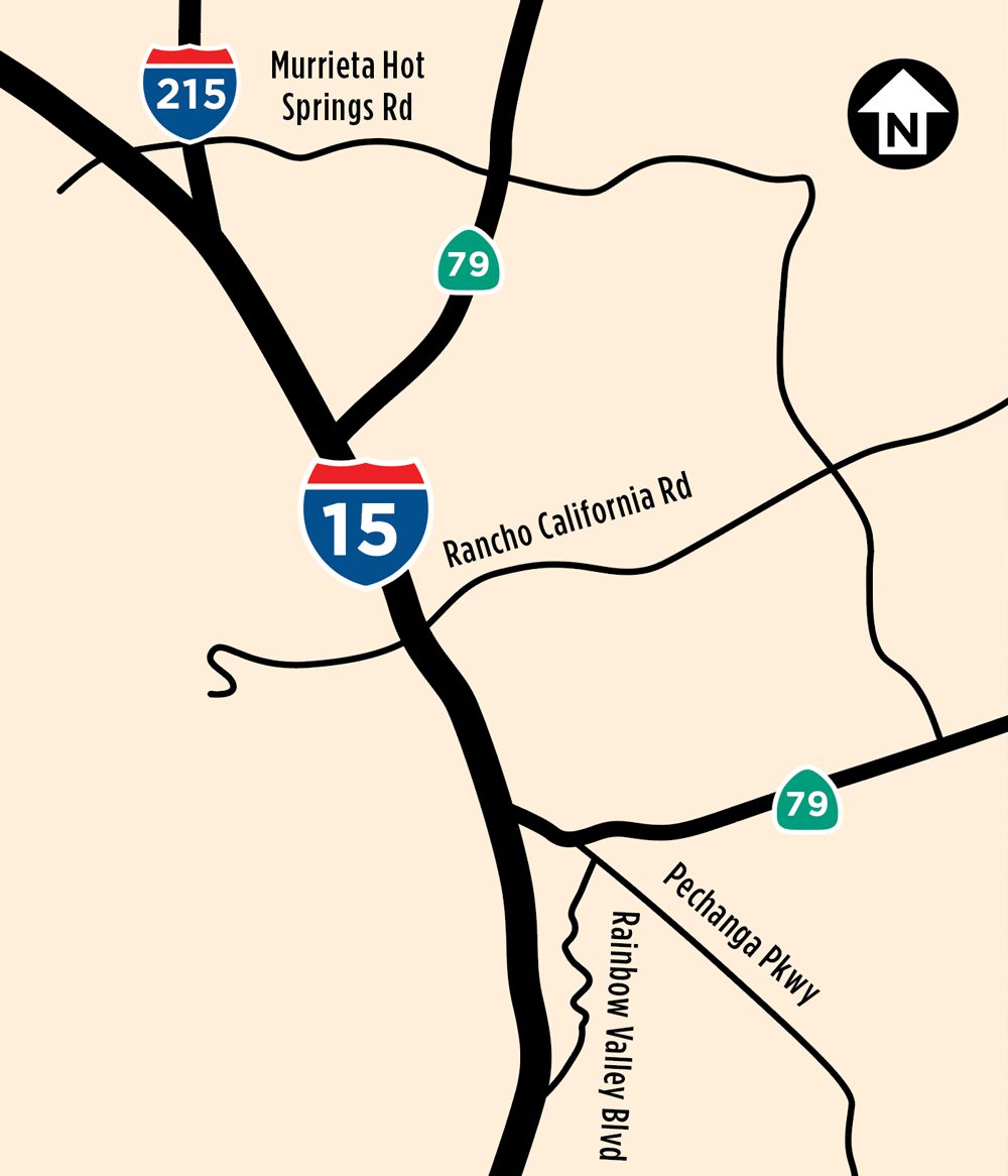
Map courtesy of Riverside County Transportation Commission
Evaluations over the two-year trial period will be used to determine the system’s effectiveness and potential for broader implementation. Tapia says he is aware of cities north of the pilot’s I-15 segment eyeing the system as a possible solution, in addition to cities to the east along Interstate 10 through the San Gorgonio Pass looking to ease traffic in these corridors.
As recent distribution warehousing projects come to life throughout Riverside and San Bernardino counties — including Amazon’s new 635,000-sq.-ft. inbound cross-dock warehouse in Desert Hot Springs; TireHub’s 404,725-sq.-ft. distribution facility in San Bernardino; an 886,000-sq.-ft. warehouse in Jurupa Vallery for Custom Goods and White Cap’s 332,340-sq.-ft. distribution center in Perris — the opportunity to mitigate year-round traffic congestion could become a game-changer for the region’s speed-to-market capabilities.
“There are other parts within our county looking at this as a possible solution,” Tapia says. “In fact, because we are the first in California to do this, I’m pretty sure we have other counties and transportation agencies looking to us to see what this data can tell them.”