
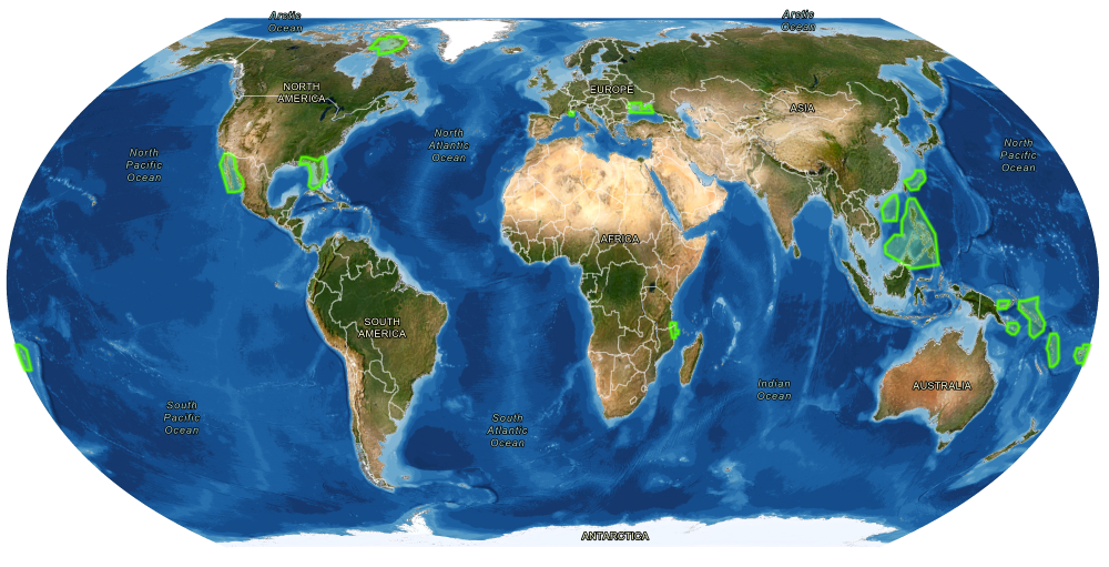
Greenwater Foundation, Caladan Oceanic and TCarta Marine have teamed to contribute more than 200,000 sq. km. of satellite-derived bathymetry (from ESA’s Sentinel-2 satellite imagery) to Seabed 2030.
All images courtesy of Caladan Oceanic and TCarta
The Seabed 2030 Project aims to compile a map of the entire seafloor by the year 2030. The detail work starts at the coasts, but a company driving the project is in Colorado.
A release from Caladan Oceanic this week informed us that the marine technology company owned by Victor Vescovo “has provided significant financial support and guidance to Greenwater Foundation to source new mapping data of the seafloor in coastal areas using Satellite-Derived Bathymetry (SDB). This initiative will support the mission of The Nippon Foundation-GEBCO* Seabed 2030 Project, which aims to compile a map of the entire seafloor by the year 2030.” GEBCO makes full data sets available, alongside instructions on how to submit more data for its ambitious project.
The National Oceanic and Atmospheric Administration says the term “bathymetry” originally referred to the ocean’s depth relative to sea level, but today it has come to mean “submarine topography,” or the depths and shapes of underwater terrain. “Bathymetry is the foundation of the science of hydrography, which measures the physical features of a water body,” NOAA says. “Hydrography includes not only bathymetry, but also the shape and features of the shoreline; the characteristics of tides, currents, and waves; and the physical and chemical properties of the water itself.”
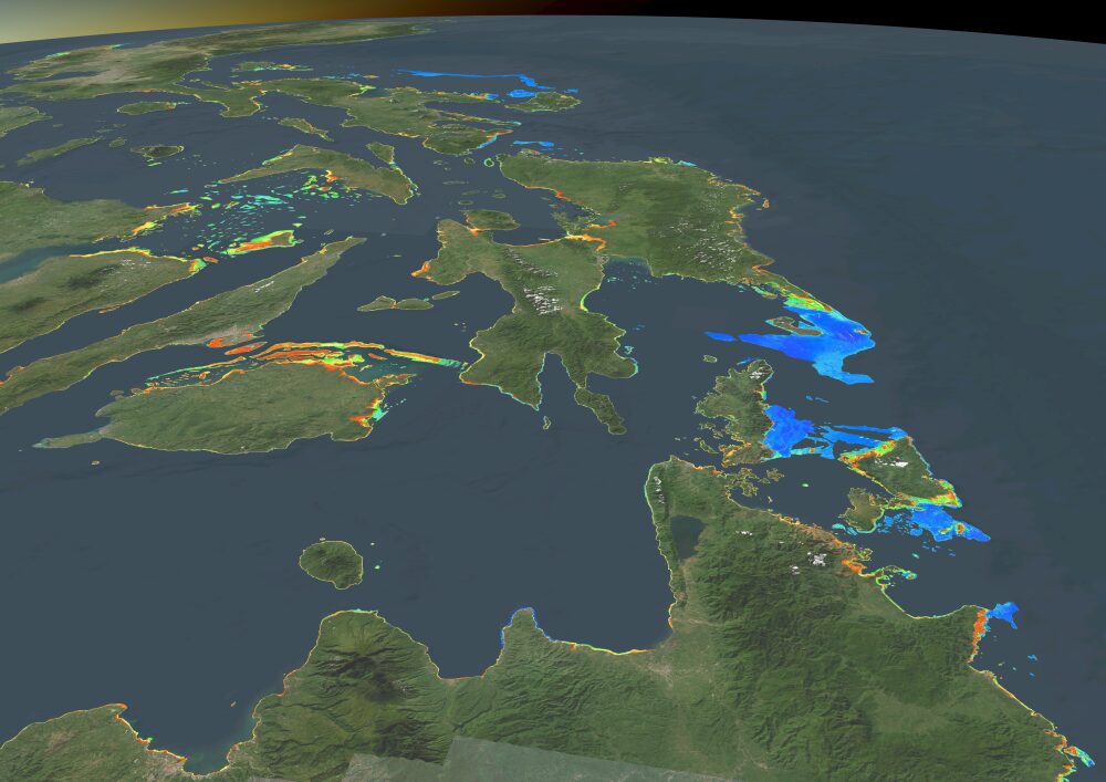
The Philippines
The work is being conducted by TCarta, a Denver-based company that specializes in using satellite data in the visible and other spectra of light. For this particular tranche of contributed data, the total amount of area generated by TCarta and Greenwater Foundation for GEBCO was 217,560 sq. km. (exactly 84,000 sq. miles) at a weighted average resolution of 10 meters.
Among the areas mapped this time around (the project aims to be complete by Christmas Day) are coastlines in Florida; Baja California, Mexico; the South China Sea; Mozambique; Monaco; and the Philippines, among others.
“The data was provided to the appropriate oceanographic offices of the countries that were mapped,” said Caladan Oceanic. “The data will also be used to provide more awareness about potential coastal hazards, enable more precise fisheries and resource management, and for other marine scientific uses.”
I reached out to TCarta President and Founder Kyle Goodrich to ask how these data might be used to inform corporate real estate location decision-making and other infrastructure and economic development processes.
“We have examples of SDB used in ports to aid in dredging activities and monitoring of adjacent banks and sandbars,” he says by email. In many ways an ongoing activity, dredging has been especially relevant to the efforts of many ports to accommodate ever larger cargo ships.
Kyle Goodrich, Founder and CEO, TCarta
With today’s volume of data center projects and related subsea cables encircling the world, I asked Goodrich how TCarta’s services and projects such as Seabed 2030 might influence the paths and projects chosen for subsea cables.
“SDB is useful for planning landing areas for cables and pipeline routing in the nearshore areas,” he says. “We have completed several cables route projects in Africa.”
According to Pitchbook, TCarta, founded in 2014, has 26 employees and has received support from federal programs as well as from St. Louis-based accelerator Capital Innovators. The firm’s projects have included helping Jamaica map its “Exclusive Economic Zone” in order to better measure and plan for protection and growth of its blue economy and determining water depths along the Oman coastline to help avoid ship groundings.
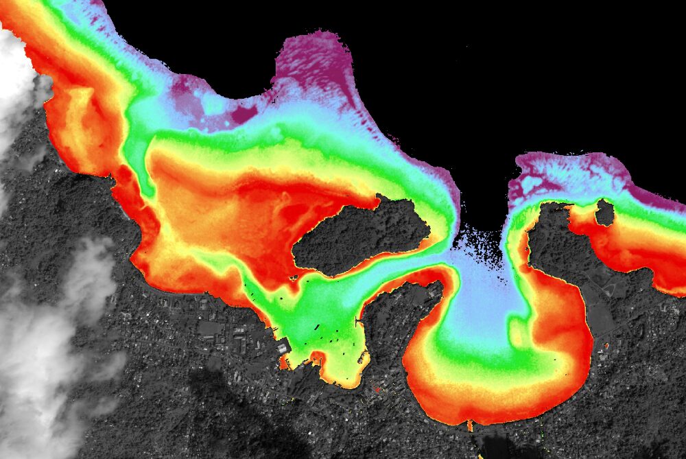
Port Antonio, Jamaica
The Caladan Oceanic release points out that satellites sure beat previous methods of data collection. “SDB offers the benefits of an extremely short timeframe from collection to delivery when compared with boat or airplane-based methods, making this an ideal technology for mapping coastal areas where repeated mapping with aircraft is costly and can take years to process and release the data,” it said. “SDB also provides the lowest carbon footprint per square kilometer mapped compared to aircraft or ship-derived mapping.”
Like everything else, Seabed 2030 also aims to employ AI. “One of the objectives of the project is to use the initial phases of the work to train a machine-learning tool to augment human operators analyzing overhead imagery data with which to generate maps of the seafloor,” the release stated. “Over time, it is hoped that this ongoing project can develop a greater ability to map more of the seafloor, with much greater cost efficiency and accuracy, than has ever been possible before.”
“Hopefully this is just the beginning of a significant, charitable effort to generate more coastal area maps that are difficult to map and then provide them to GEBCO’s open-source database and to the world community for free,” said Victor Vescovo. “One can’t understand the global climate, ecosystems, manage resources and safely navigate the ocean without knowing what is there. Right now, 74% of the ocean is completely unmapped. We have detailed maps of the moon and Mars, but we have somehow skipped over half of our own planet.” — Adam Bruns
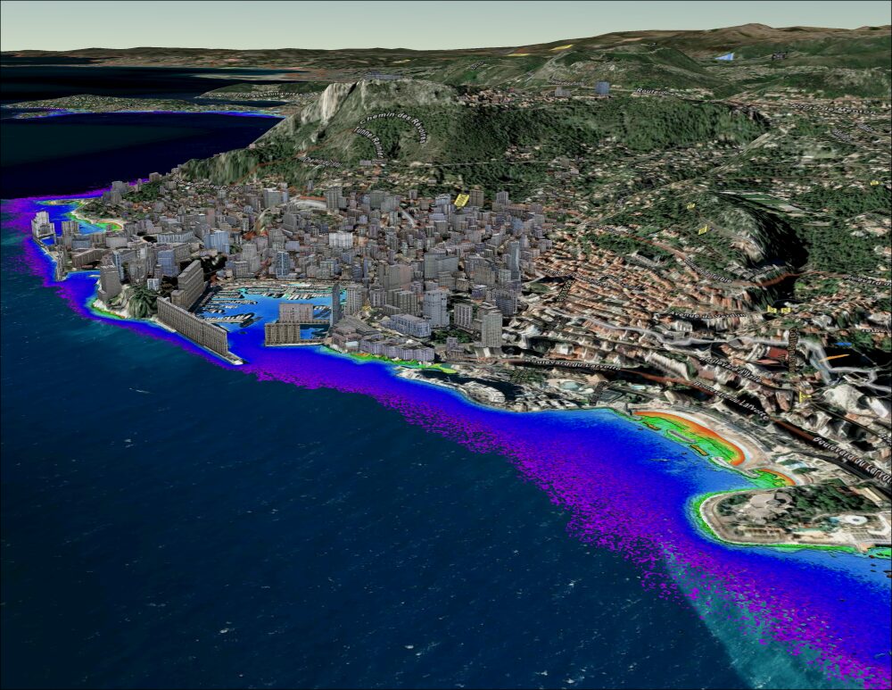
Monaco