Using a combination of aerial photography and satellite imaging, Keyhole (www.keyhole.com) has mapped the globe, allowing users to take a virtual magic carpet ride.
A three-year-old company based in Mountain View, Calif., Keyhole first gained attention during the first days of the war in Iraq in March 2003, when news organizations used the technology to show in detail where the fighting was taking place.
Keyhole is also partnering with Tactician Corp. (www.tactician.com), Andover, Mass., to integrate its Tactician Online marketing portal with Keyhole2 PRO. The combination of the two technologies allows users to create maps with an overlay of marketing information.
Noah Doyle, who heads Keyhole’s strategic marketing effort, says the major advantage Keyhole offers site selectors is a visual context for a location that previously was only available through travel. Doyle says corporate real estate is one of the company’s fastest growth areas, with about a dozen Fortune 500 firms currently using Keyhole.
“It enables them to really see in a matter of minutes whether a site meets their basic criteria, whereas in the past it would have taken days or weeks,” Doyle says.
The ability for those involved in the site selection process to collaborate is another important feature, Doyle says.
“What we have seen in the last year is a recognition among corporate real estate officials that they can achieve significant production gains in their jobs through Keyhole,” he says. “The benefits of information technology are now reaching real estate in the way they helped revolutionize other corporate functions in the past.”
Keyhole offers high-resolution visuals of the 70 major metropolitan areas in the U.S., covering these regions at building-level detail. Outside the metros, Doyle says medium-resolution visuals are available, showing major geographical features and large structures as well as detailed mapping.
Multiple Points of View
About a dozen economic development agencies now employ Keyhole.
One of the first to adopt the technology was the City of Ontario economic
development department in Southern California, which has now been using
it for about two years. Brian McGowan, the city’s economic development
manager, says it’s been a valuable tool. He says it helps him show prospects
how close the city is to Los Angeles and San Diego. “We’re extremely
happy with it,” McGowan says. “We use it at trade shows where we put
it on a 48-inch [122-cm.] plasma screen. It’s a nice way to draw people
in.”
 |
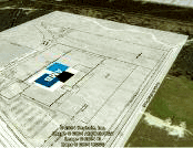
| AMB Property Corp. uses Keyhole to illustrate how a project next to the airport in Houston will look. |
McGowan says he also uses Keyhole in his office to give virtual tours of Ontario. The city has provided Keyhole with a layer of specific information on “essential parcels.” McGowan can zoom in, for example, on a piece of industrial property the city is marketing and also show pertinent information such as square footage and zoning. Another handy tool is the ability to e-mail a photo directly from Keyhole applications.
Using Keyhole, McGowan can also show Ontario’s geographical relationship to the largest cities in Southern California.
“It’s important to brand ourselves as Ontario, but it’s also important to show our proximity to Los Angeles and San Diego,” McGowan says. “It’s great for working with companies looking to move here and for working with existing companies looking to expand.”
While McGowan says Keyhole works for him, there are always more layers of information that could be added, such as demographic data.
“It’s so easy to use,” he says. “I can get on the phone with a prospect and can very quickly open it up and get all kinds of information, which in turn makes us look good.”
AMB Property Corp., a San Francisco-based REIT, has been using Keyhole since early this year. AMB manages more than 100 million sq. ft. (9,290,000 sq. m.) of industrial real estate in major hub markets in North America, Europe and Asia. AMB has a need for aerials and maps showing these buildings and where they are located within a given market. A company division that raises capital also uses Keyhole as part of its sales demonstration.
“It’s one of the most interesting softwares we have used in a long time,” says John Meyer, AMB’s senior vice president and director of its Airport Facilities Group. “It has the ability to create movies of any particular fly-around that we want to do.”
Meyer says he also uses Keyhole to designate locations of planned buildings and show them on an existing aerial.
“It [Keyhole] has made my life a lot easier,” Meyer says. “I run a group that acquires assets around airports. We can look at a particular cargo building at an airport. The ability to zoom in on particular buildings is fabulous.
Keyhole can also “pre-define” image locations. For example, if Meyer wants to look at a particular location near the Miami airport, he can not only create a movie flying in from the outside world to the airport, but he can pan around and show what’s in any given direction.
“That’s a nice feature compared to just aerials, which have a top-down look,” Meyer says.
Dave Twist, AMB’s vice president, research, says Keyhole is especially valuable in looking at international properties in cities such as Beijing, Tokyo and Mexico City, where good aerials were not previously accessible. He says Keyhole will soon host on its server an information layer of AMB’s portfolio.
“It’s not the same as being there, but it’s second best,” Twist says of Keyhole.
